Producers of Verified Views
Producers of Verified Views
Producing Verified Views at high levels of accuracy as supporting evidence for Landscape and Townscape Visual Impact Assessments (TVIA & LVIA) and for expert witness at public inquires.
Specialising in Verified Views, we excel in providing exceptionally Accurate Visual Representations (AVR) critical for Landscape and Townscape Visual Impact Assessments (LVIA & TVIA).
Our extensive experience in the industry has solidified our reputation for producing verified views. Commitment to meticulous detail ensures a reliable forecast of potential alterations to existing landscapes, offering visuals that are not only accurate but also stand the test of rigorous examination.
Jump to: GALLERY
WHAT IS A VERIFIED VIEW?
A Verified View Photomontage / Wirelines or an Accurate Visual Representation (AVR), is a tool used to help inform the effect of a proposal by providing three dimensional visualisations of it.
Understanding the complexities of architectural designs can be a challenge for many. To facilitate this understanding, images that offer an AVR of a proposal within its real world context are indispensable for both experts and the general public. Utilising such images during the design phase allows for precise tailoring of development features such as building height, mass, and material choices.
Especially in planning contexts, such as during public consultations or public inquiries, verified views play a critical role. They set forth a clear and realistic expectation of a development's aesthetic and physical impact, building trust among the public, planners, and developers, which is crucial for effective feedback and project refinement.
This method involves creating a view from an actual, specified location, as opposed to an imaginary vantage point. It combines real photographic evidence with precise computer aided design 3D models of the proposed development, ensuring a high level of detail and trustworthiness.
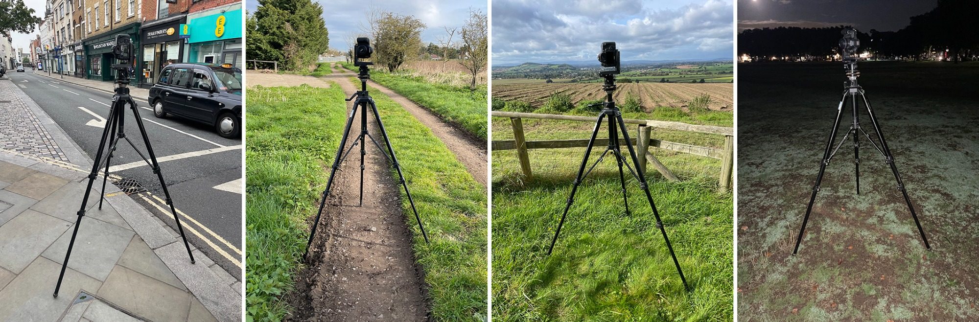
PHOTOGRAPHY and SITE SURVEY
Our process includes capturing high quality photography, which is performed with on site surveying. Precisely documenting the camera lens's position and elevation (Above Ordnance Datum), along with 6 to 10 physical reference points for each viewpoint, guarantees verified views that are both precise and trustworthy.
The collected data is then integrated into advanced computer modelling software. This step is crucial as it enables us to craft an accurate visual representation, mirroring the genuine panoramic photograph with exceptional fidelity. Thus providing our clients with a reliable visual tool to envision potential developments and changes within the environment.

Producers of Verified Views in all areas within the UK
We need your consent to load the translations
We use a third-party service to translate the website content that may collect data about your activity. Please review the details in the privacy policy and accept the service to view the translations.